All apps
Transport · DK

Wingtrace – flyradar & kamera

Which plane is that up there? Point your phone at the sky and find out.

What it does

Wingtrace shows the aircraft above you while they fly. The world map is built into the app, so there are no map tiles to download — the only thing that costs data is the aircraft positions. Tap a plane for a photo, its route, altitude and the raw figures from the transponder.

  • Every aircraft in the air on the map, updated every five seconds
  • Point at the sky and see which plane it is
  • Photo, route and the transponder's own figures
  • Over 2,000 airports with runways and a picture
  • Follow a flight and get told when it takes off or lands
  • The map is built in — only the aircraft cost data

Wingtrace is not affiliated with any airline, airport or authority, and must not be used for navigation or flight planning. Coverage is uneven: aircraft without ADS-B and aircraft at low altitude are missing, and positions can be delayed or incomplete.

How it works

Which plane is that up there?

Aircraft broadcast their own position. Wingtrace listens in, draws them on a map that lives inside the app, and lets you point your phone at the sky to get the name of the exact aircraft you can see.

01

The map is built into the app

Most map apps fetch tiles as you pan. Wingtrace does not: the whole world map is in the app — coastlines, lakes, borders, 34,000 towns and 14,844 runways. The map is there immediately, including the first time, and the only thing that costs data is the aircraft positions. You notice that on roaming.

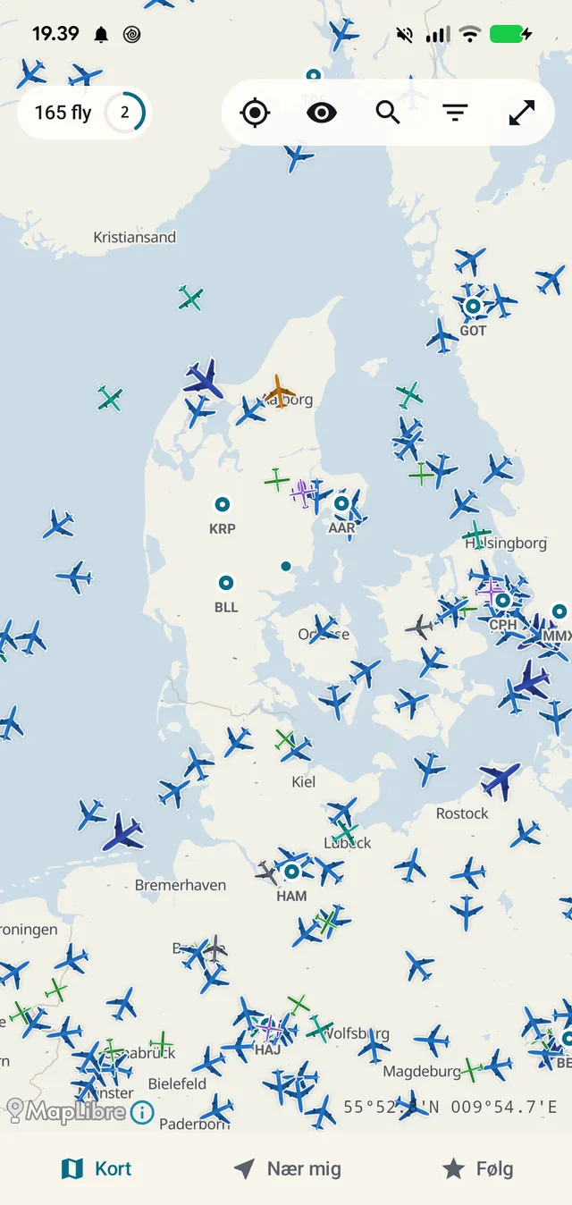
Every aircraft is drawn to its weight class: an airliner takes more room than a small propeller plane, and the shape and tone follow. Colour carries altitude. The counter at the top left shows how many aircraft are in view, with a small dial that turns while data is being fetched.

Aircraft move smoothly between fetches. That takes two things rather than one — a projection between measurements, and a smoothing towards the new position when it lands — or every aircraft jumps once every five seconds.

Turn on 'detailed map' if you want roads and more place names. At the bottom right the centre of the screen is given as a coordinate in degrees and decimal minutes, as on an aviation chart.

  • The whole world map is in the app — no tiles to download
  • Aircraft update every five seconds and move smoothly in between
  • The icon is scaled to the aircraft's weight class
  • Day and night maps, your choice
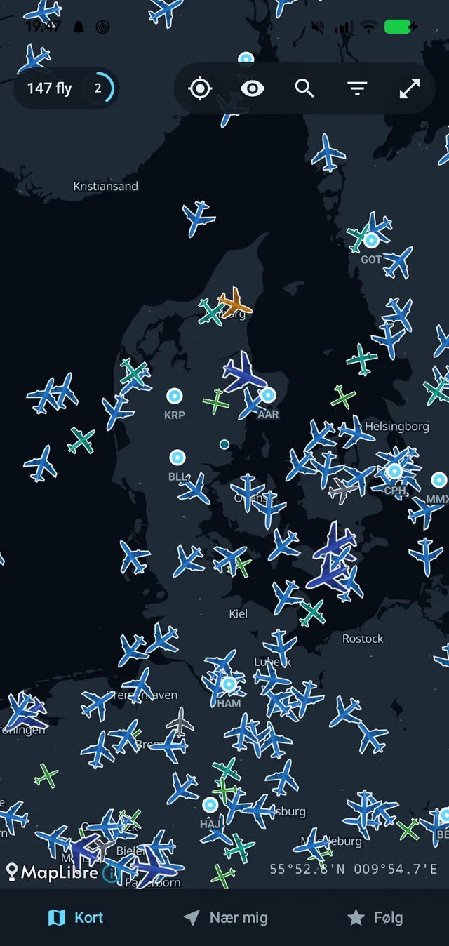
165 aircraft over Denmark and northern Germany. Airports carry their IATA code.
02

Point at the sky

The question the app is built around is not 'where are the aircraft' but 'what is THAT one'. Lift the phone and the camera shows the sky with the aircraft drawn where they actually are — with callsign, altitude and distance.

It shows only the aircraft you could realistically spot. The app accounts for both the curvature of the earth and the size of the aircraft: an airliner 46 km away is included, a dot at 100 km is not. Aircraft behind you or too far off appear as a line at the bottom — '5 behind you, 8 too far away to see' — rather than being drawn somewhere they are not.

The feature is not called AR anywhere in the app. It is a movement, not a technology: you point, and the app answers.

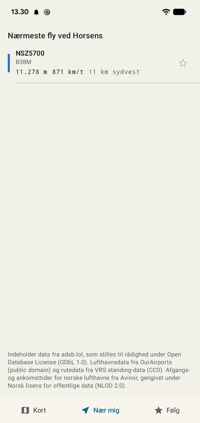
'Near me' gives the closest aircraft with distance and direction — here 11 km south-west.
03

The whole aircraft on one screen

Tap an aircraft and the strip comes up: callsign, type, registration, operator and country. Drag it all the way up for the rest.

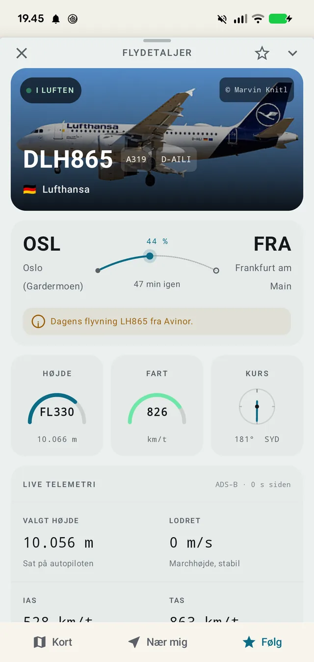
At the top a photo of that specific aircraft — not a generic shot of the type — with the photographer's name. Below it the route as an arc with how much has been flown and how many minutes remain. And for Norwegian airports, today's actual flight as reported by the airport itself, rather than a guess from a timetable.

Then the figures: altitude as a flight level and in metres, speed, heading in degrees and compass point. And finally what other apps charge a subscription for — live telemetry from the transponder: the altitude the pilot has set on the autopilot, climb or descent in metres per second, indicated and true airspeed, mach, and the wind and temperature at the aircraft's altitude.

The code sits on top with the plain-language value underneath: “FL330” with “10,066 m” below it. Monospaced type is used only for codes — callsigns, registrations, coordinates. Everything else is ordinary type.

  • A photo of the individual aircraft, with photographer credit
  • Route with the share flown and minutes remaining
  • Altitude, speed and heading — code and plain language side by side
  • The transponder's raw figures: selected altitude, IAS, TAS, mach, wind
DLH865 from Oslo to Frankfurt: 44% flown, 47 minutes left, and the telemetry below.
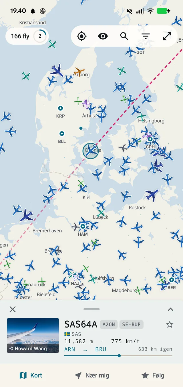
The panel opens at half height so it does not cover the route. The dashed line is a great circle.
04

The route is shown only when the geometry supports it

The route table knows the callsign for most scheduled flights, but not every match is the right flight — and a wrong route is not 'roughly right', it is an entirely different journey.

So every route is checked against the aircraft's actual position before it is drawn: is the aircraft inside a corridor around the great circle, has it got somewhere between just before departure and just after landing, and is it pointing the right way while there is still a long way to go? If any answer fails, the route is hidden — but the aircraft stays on the map.

The thresholds are calibrated against 24 real flights over Denmark rather than guessed. Airways do not follow the great circle, so the corridor is generous; the heading test is used only while more than 15% remains, because an aircraft on final approach turns.

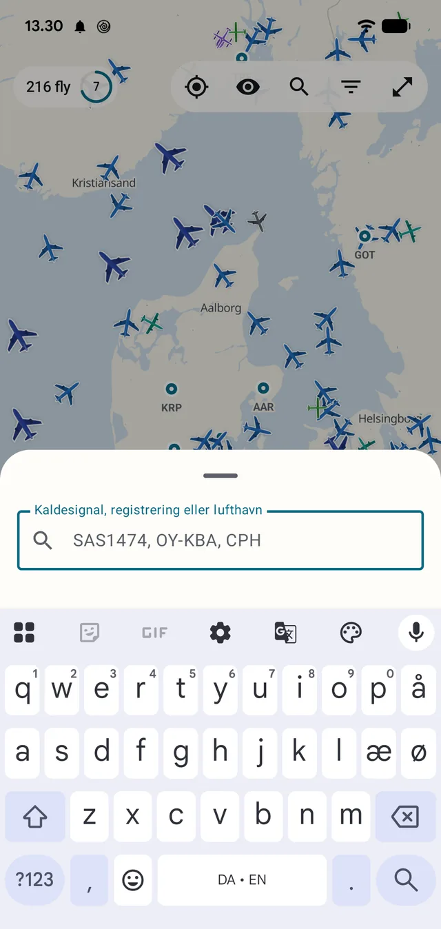
Search by callsign, registration or airport.
05

Airports with runways and a picture

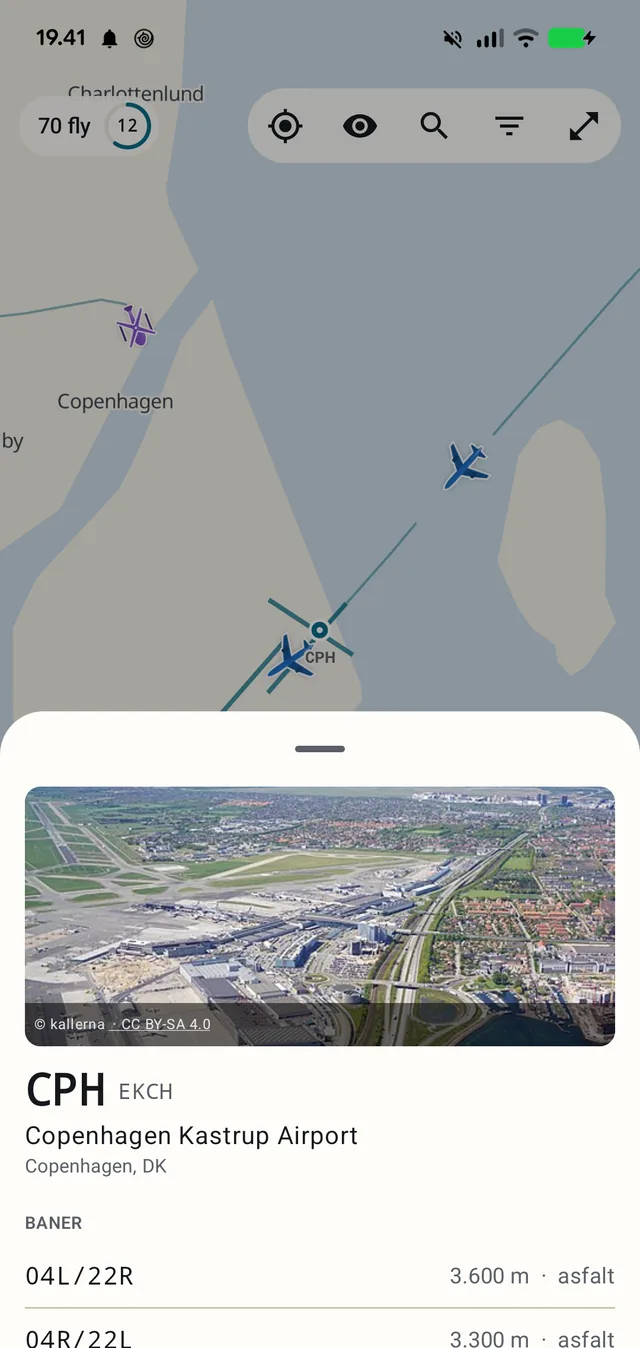
Tap an airport on the map and you get its IATA and ICAO codes, full name, city and country, a picture, and the runways with designation, length and surface.

Over 2,000 airports have a picture. The rest of the 14,844 runways are still there — they are part of the built-in map.

Copenhagen: runways, lengths and surfaces, with a picture from Wikimedia and its credit.
06

Follow a flight

Star an aircraft and it joins the follow list. You can then see it even when it is outside the map view — and with notifications on you are told when it takes off or lands.

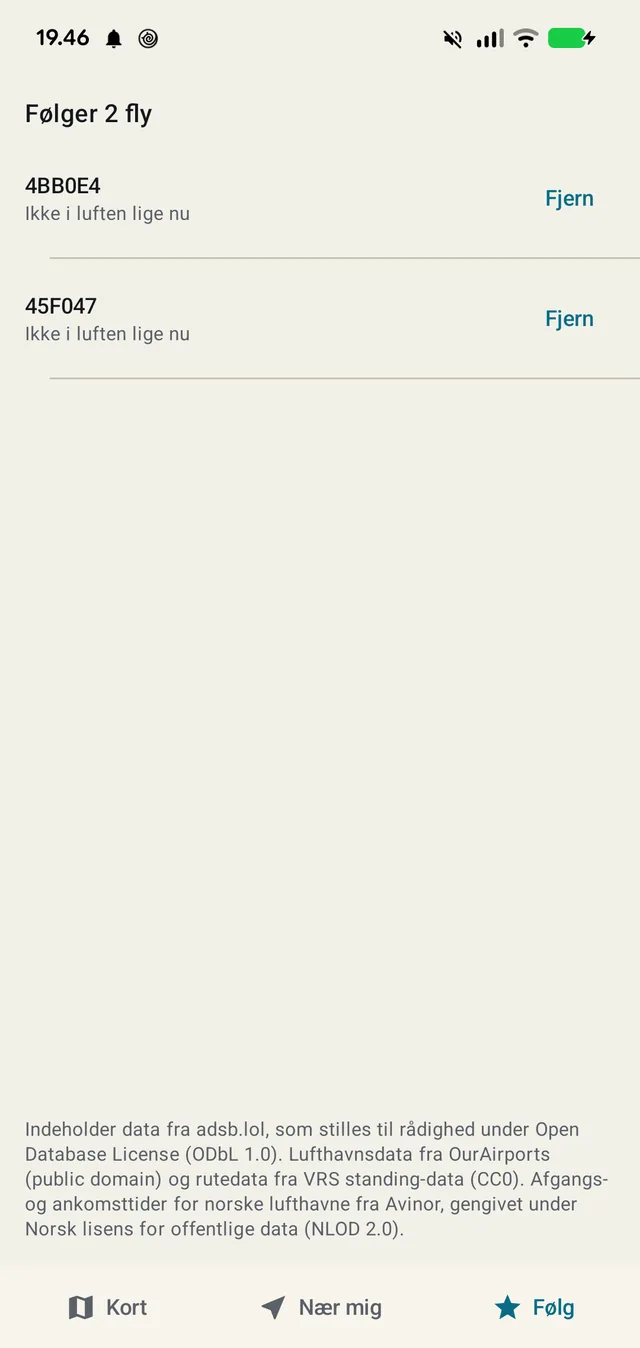
The list shows the status of each aircraft, including when it is not airborne. A flight that has landed does not disappear; it simply says it is not flying right now.

The app fetches only while it is in the foreground. That sounds obvious and is not: a polling loop in a modern UI framework does not stop by itself when the screen goes off, and an early version therefore fetched around the clock. It was fixed because the data source stopped answering.

The follow list. An aircraft that is not airborne stays with its status.
The night map. Aircraft are outlined in their own colour so the silhouette holds on a dark ground.

Where the data comes from

Aircraft broadcast their own position via ADS-B. The signals are collected by volunteers with aerials on their roofs. Every source is open, and the attribution is in the app — not only here.

adsb.lol
Aircraft position, altitude, speed and transponder data — Open Database License
OurAirports
Airports, runways and frequencies — public domain
VRS standing data
Routes and aircraft types tied to the callsign — CC0
Avinor
Today's actual departures and arrivals for Norwegian airports — NLOD 2.0
Planespotters
Photos of the individual aircraft, with photographer credit
Wikimedia Commons
Airport pictures, with licence and credit
OpenFreeMap
The map style — day and night, same licence and same sources